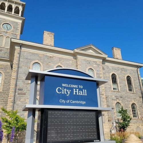

I had a very interesting week. It was the first time in nearly 20 years that I had an Archeological Assessment cause me some serious headaches in a negotiation. In fact it was the first time I had ever had to deal with one and it quickly became apparent that I had a lot to learn. I called some builder friends of mine to ask them what they knew of these studies and they were not really any better informed than I was.
Being of an age and inclination where a great Saturday night is binge watching History Hits on YouTube well past my bedtime, I was happy to jump down this rabbit hole.
So the following is what I learned. We will look at what an Archeological Assessment is, how they work, look at time lines, requirements, when they are needed as well as explore some examples.
Note that I have cited sources throughout which you can find at the bottom of this post with hyperlinks should you wish to explore something further.
What Is an Archaeological Assessment?
To begin with, what exactly are these things? An archaeological assessment is a study, done by a licensed archaeologist, that looks for evidence of past human activity on a property before the ground is disturbed. The "before" as we will see does a lot of heavy lifting in that definition. The Province requires one when land has either a known archaeological site or the potential to contain one [1]. In Ontario's rules, an artifact is anything "made, modified, used, deposited or affected by human action that has cultural heritage value or interest" [2]. That covers everything from a stone tool left thousands of years ago to the foundations of a 19th-century hotel.
It is important to know that the Province has some rules about who can do these and whom they will recognize. Only licensed archaeologists can carry out assessments. Luckily for all, the Province publishes a list of everyone who holds a licence [3]. Part VI of the Ontario Heritage Act makes it illegal for anyone but a licensed archaeologist to knowingly disturb an archaeological site [4].
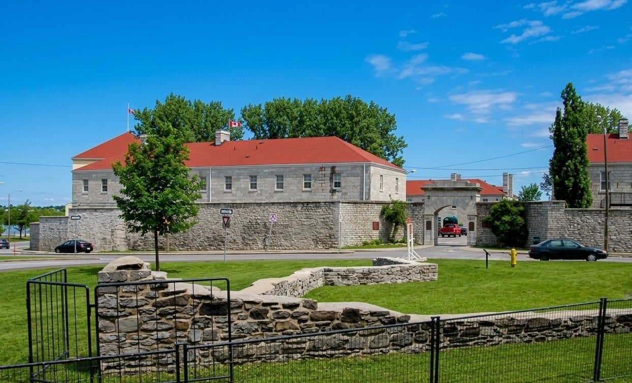
To be candid, given what I do for a living, I can sympathize with those who see these as yet another expense and pain in the neck. On the other hand, they are important. The French, for example, built a fort in my home town sometime in the 1600's and you can go there today and see a good part of the foundations (that's the photo above) which I think is great. The fact that nobody slapped a Petro-Can on top of it is simply dumb luck given it was buried until 20-30 years ago. So these rules are a good thing over all.
Why Do Cities Ask for One?
When the planning department asks for an Archeological Assessment before granting development permission, it's not them. It flows down from provincial planning law. Every planning decision in Ontario must be consistent with the Provincial Planning Statement, 2024, which is issued under section 3 of the Planning Act [7]. Policy 4.6.2 of that statement says planning authorities shall not permit development and site alteration on lands containing archaeological resources or areas of archaeological potential unless those resources have been addressed [8].
So, big or small, when you apply for a subdivision, severance or rezoning, the municipality adds an archaeological assessment as a condition of approval to make sure the developer meets its legal obligations under the Ontario Heritage Act [1]. The city then decides whether the condition is satisfied, but the report itself goes to the Province. The Ministry of Citizenship and Multiculturalism reviews it, issues a letter of acceptance when it meets provincial standards, and enters it into the Ontario Public Register of Archaeological Reports [2].
For where I work, Waterloo Region is particularly well mapped. The Region has an Archaeological Facilities Master Plan that documents known resources, and regional studies through Kitchener and Cambridge have found elevated potential near the old historic villages - now the major cities. They have also noted things like early transportation routes and heritage properties, with features within 300 metres (the 300M is important as we shall see in a moment) that contribute to the potential there is something of importance [9].
Is This Like an Environmental Report?
Up until this week I had thought of them as something akin to Environmental Reports - which I am very familiar with. This was kind of right and kind of wrong. In structure, yes Archeological Assessments are much like Environmental Reports. Like a Phase One and Phase Two environmental, is staged, starting with desk research, and only moves to fieldwork when the research shows risk, and is often a condition of approval.
But in substance, no. An environmental report looks for contamination - was there a gas station here with a drive through drycleaner? An archaeological one of course looks for people and it answers to a different statute, a different ministry and a provincial register. As a consequence, the difference is that the solution to any potential issues is different: contamination can usually be cleaned up for a price, while a significant archaeological site must either be protected in place or professionally excavated and documented before construction [1].
So if you have dirty land, you can clean it up by writing a cheque. Little different with archeological significant site.
Where Does It Apply?
The rules are the same everywhere in Ontario. What varies is whether a specific property triggers them. The Province's screening checklist asks, among other things, whether there are known archaeological sites or documented Indigenous use within 300 metres of the property [10]. Water is the other big one: archaeologists treat undisturbed land within 300 metres of a lake, river or large creek, and within 200 metres of a stream, spring or marsh, as having potential [11].
The Province has of course written the legislation with reality in mind. If the entire property has been subject to "recent, extensive and intensive disturbance", no assessment is required, although it is recommended that owner should keep documentation proving it [10]. That is why many downtown sites clear quickly. It makes sense if things like basements, grading and servicing have already removed most of what was there.
But what is "extensive and intensive"? Think of a parking lot for example. Assessors see that things like pavement can act like a lid. A downtown Stage 1 in Uxbridge noted that in an urban setting, deeply buried archaeological resources can remain sealed and entirely preserved under later development [12].
Finally, there has to be some reason why an assessment is required. Assessments are typically triggered by 1. a development approval under the Planning Act, 2. by infrastructure projects under the Environmental Assessment Act, or 3. by activities like quarrying and pipelines [1].
How the Process Works
OK, so how exactly do these assessments work? Well, the Province lays out four stages, and not every project needs all four [1].
Stage 1 is background research and a property inspection. The archaeologist reviews historical, geographic and land use records, checks the ministry's database for known sites nearby, and walks the property. If there is potential, Stage 2 is required [1].
Stage 2 is the field survey. On ploughed land, crews walk the field looking for surface artifacts. Elsewhere, they dig rows of small test pits at regular intervals down to subsoil and screen the soil. Paved or filled urban sites often call for other methods, such as machine trenching [1]. If nothing significant turns up, the file ends here.
Stage 3 only happens when something is found. The archaeologist maps the site's boundaries using one-metre by one-metre test units and evaluates its cultural heritage value [1].
Stage 4 is mitigation. The preferred option is protection in place, where development proceeds around the site with long-term safeguards like restrictive covenants or zoning. If that is not possible, the site is fully excavated and documented before construction begins [1].
What is important to remember, and this is the one piece of advice I would give, timing matters more than most owners expect. Stage 1 can happen any time of year, but provincial standards do not permit fieldwork when the ground is frozen or covered in snow, and winter work requires ministry sign-off on a proposed approach [13]. An owner who starts in late fall may be waiting until spring.
Also as we are going to see below, booking someone to do the assessment can see you waiting a while.
Ontario Archaeology by the Numbers
When I came across these numbers I was quite surprised. The ministry receives about 3,000 archaeological reports a year [4]. The Ontario Heritage Trust, for it's part, reports an average of 2,500 archaeological projects a year, roughly 1,000 new sites found each year through fieldwork, 467 licensed individuals, and more than 32,000 sites in the ministry's database [5].
While interesting, one number is important: there are only 467 licensed individuals for the whole Province. When I tried in July and August to speak with an assessor - and I reached out to 2 very large global consulting engineering firms- it was very difficult to get anyone to call me back. As we discussed above, timing for the process is important yes but timing for lining up the consultant is also important.
Five Ontario Examples
Again not having had any personal experience with environmental assessments, I wanted to look up some noteworthy projects that had some interesting elements to them.
Toronto: a Parliament under a car wash. Upper Canada's first parliament buildings, burned during the War of 1812, disappeared under more than a century of industrial use. In 1973 the corner of Front and Parliament held a gas station and a car wash [14]. An excavation was triggered in in 2000 and it uncovered artifacts from the parliamentary period [14], including charred floor joists extending into a stone footing [15]. In a couple parcels, the Ontario Heritage Trust acquired one parcel in 2005, and in 2021 the Province acquired the entire block for the Ontario Line subway, with Metrolinx carrying out further excavations from 2022 to 2024 [14]. Good and wise people as they are, Metrolinx deliberately built time into its schedule for thorough investigation before construction [17], and the Trust's guidance for the block called for minimizing excavation and concentrating new building at the Front Street end [16]. This one of interest to me in that here is a really significant archeological site, and the assessment did not kill the project. Granted Metrolinx has a lot more pull than the average developer but nonetheless it is interesting.
Stouffville: a village beside a subdivision street. In the late 16th century, there was a village of some 1,500 to 2,000 people believe it or not that stood just east of what is now Reeves Way Boulevard in Stouffville [6]. The assessment was triggered, or rather the thoroughness of the assessment was triggered in part, given it's proximity to a waterway. Today, there is the Jean-Baptiste Lainé Site, which many of you visit regularly no doubt, which is open to the public. They offer self-guided trails through the land that once held this lost to history small town from the 1500's. Interesting example of waterways triggering assessments.
Kitchener: the south-end growth area. Just a few minutes down the road from my office, a 2022 Stage 1 and 2 on Bleams Road recovered 220 stone flakes, three projectile point tips and two biface fragments, enough to identify a potential Late Woodland village [19]. Nearby, a mixed-use project of 411 units with about 1,732 square metres of ground-floor commercial space went through Stage 1 and 2 the same year, and the field survey identified one new archaeological location [20]. A great example of a recorded and documented addition to our history... along with 441 new units.
Uxbridge: downtown is not automatically clear. Uxbridge was undertaking infrastructure construction in its downtown and a Stage 1 was required. Despite the fact that the site had decades of very significant disturbances including downtown flood reduction works, cleared roads, building footprints and culverts, a Stage 2 was recommended. Uninterestingly they found the foundations of a building from around 1855. Interestingly, this is an example of the text-book definition of a disturbed site yet a Stage 2 was still required. [12].
Cambridge: a hotel under a parking lot. This last example relates to a small infill parcel in Preston's (Cambridge) historic core. The property was mostly a paved parking lot behind an existing building. Historical research, including old city maps from the 19th-century and a 1910 fire insurance plan, flagged former buildings. Accordingly a Stage 2 was required and the archaeologists used machine trenching for that Stage 2. By mid-May 2022 the trenches had exposed foundations and flooring of the mapped structures. On May 18, the consultant asked the ministry to combine Stage 2 and Stage 3 to protect the client's timeline, and the ministry approved it the same afternoon. Twelve days later, the ministry confirmed the work had moved into Stage 4. By November 2022, the 19-by-20-metre site had been fully excavated and documented, with no further archaeological work recommended [21]. Interesting as a perspective on downtowns as well as some insight into timelines when Stage 2 becomes a bit more involved.
What If Human Remains Are Found?
Discussing my deal this week at the office with colleagues, this was the one oddball question most of us had. This is rare, but it follows a separate set of rules. Anyone who discovers human remains must immediately notify the police or coroner. If the coroner rules out a forensic matter, the landowner will usually be required to hire a licensed archaeologist to investigate the site, and the provincial Registrar uses that report to identify and notify the appropriate representatives, such as descendants or the nearest First Nation for an Indigenous burial ground [22].
The Rules Are Changing
Finally, let's look at where the legislation is heading. Getting technical for a moment, the core framework dates back to the Ontario Heritage Act of 1975 [23]. The technical rulebook archaeologists follow today, the Standards and Guidelines for Consultant Archaeologists, replaced the 1993 technical guidelines [24] and has applied to all consultant archaeologists since January 1, 2011 [13].
So think the law and the manual.
Two changes are now in motion. First, amendments to the Ontario Heritage Act made through the Protect Ontario by Unleashing our Economy Act, 2025 created an authority to exempt properties from archaeology requirements, and the Province has proposed criteria for when that could apply [25]. Second, the ministry piloted an updated draft of the Standards and Guidelines during the 2026 summer field season and intends to finalize it in late 2026 [26]. The Province's stated goals include new standards for limited assessments and partial clearance to help keep projects moving [27]. Partial clearance is the one to watch: it would let development proceed on cleared portions of a property while work continues elsewhere.
What This Means If You Are Buying or Selling Development Land
Find out early. Before listing or making an offer on development land, run the property against the provincial checklist we discussed above and ask the municipal planner whether an archaeological condition is likely. Is there water within 300 metres? What about old roads or rail lines? is there an absence of heavy disturbance or covered in pavement? Is your the site near someone else who had to do a Stage 2?
Start Stage 1 before you need it. If you are selling, do this first. Get it out of the way. I recommend Sellers also do Phase 1 Enviros as well (where applicable). It is the same thing here - get ahead of issues and make it easier for the Buyer. Remember as well, it is desk-based and can happen year-round. If Stage 2 is needed, the fieldwork season will set your timeline, not the other way around [13].
Document disturbance. if you have these, old building footprints, grading and servicing records can remove large parts of a property from further study [10]. Keep that paperwork.
Clearance is a selling feature. Land that already has a ministry-accepted assessment with no further work recommended removes an unknown from the buyer's underwriting. Land without it will be priced with that uncertainty baked in, and buyers will negotiate conditions and timelines accordingly.
Hire from the official list. Confirm your archaeologist appears on the Province's licensed list [3], and ask how often their reports pass ministry review without revisions. (This last piece of advice came from a consultant).
And as always, have your lawyer review how any archaeological condition is handled in your agreement of purchase and sale: who pays, who carries the timing risk, and what happens if Stage 3 or 4 is triggered.
Terry Riddoch
 If you would like to talk through how any of this applies to a building you own or one you are considering, I am always happy to walk through the numbers.
Terry Riddoch
Real Estate Broker -- Multifamily and Investment Properties, Ontario
Phone: 519 591 1725
Email: [email protected]
Web:www.terryriddoch.ca
Sources
- Government of Ontario, "Archaeological assessments." https://www.ontario.ca/page/archaeological-assessments
- Ontario Heritage Trust, "Archaeology: Frequently asked questions." https://www.heritagetrust.on.ca/conservation-tools/archaeology-faq
- Government of Ontario, "Archaeologists licensed in Ontario." https://www.ontario.ca/page/archaeologists-licensed-ontario
- Government of Ontario, "Archaeology." https://www.ontario.ca/page/archaeology
- Ontario Heritage Trust, Heritage Matters, "By the numbers." https://heritage-matters.ca/articles/by-the-numbers
- Town of Whitchurch-Stouffville, "Stouffville Reeves and Mayors: A Brief History." https://www.townofws.ca/about-us/our-history/stouffville-reeves-mayors-a-brief-history/
- Government of Ontario, "Provincial Planning Statement, 2024." https://www.ontario.ca/page/provincial-planning-statement-2024
- Town of Caledon, "Terms of Reference: Archaeological Assessments" (November 2024), quoting PPS policy 4.6.2. https://www.caledon.ca/en/town-services/resources/Business-Planning--Development/Development-Services/Terms-of-Reference/TOR_Archaeological-Assessments_FINAL.pdf
- Region of Waterloo, "Stage 1 Archaeological Assessment," ION Stage 2 transit study, Cities of Kitchener and Cambridge. https://www.regionofwaterloo.ca/media/05wmepww/appendix-b6-stage-1-archaeological-assessment.pdf
- Government of Ontario, "Criteria for Evaluating Archaeological Potential: A Checklist for the Non-Specialist," as published by the City of Barrie. https://www.barrie.ca/media/11134
- City of Windsor, "Stage 1 Archaeological Assessment," Banwell Road Extension Class EA. https://www.citywindsor.ca/Documents/residents/construction/environmental-assessments-master-plans/Appendix%20E_Stage1ArchaeologicalReport_REV.pdf
- Township of Uxbridge, "Stage 1 Archaeological Assessment: Uxbridge Downtown Flood Reduction." https://www.uxbridge.ca/en/your-local-government/resources/Documents/Downtown-Flood-Reduction-Appendices/Appendix-J-Archaeological-Assessment-Report.pdf
- Government of Ontario, "Standards and Guidelines for Consultant Archaeologists." https://www.ontario.ca/page/standards-and-guidelines-consultant-archaeologists
- Ontario Heritage Trust, "Layer by layer: First Parliament throughout the ages." https://www.heritagetrust.on.ca/exhibits/layer-by-layer-2
- Ontario Heritage Trust, Heritage Matters, "Upper Canada's first parliament buildings: A place of hopes and dreams." https://www.heritagetrust.on.ca/heritagematters/articles/upper-canadas-first-parliament-buildings-a-place-of-hopes-and-dreams
- Ontario Heritage Trust, "Parliament." https://www.heritagetrust.on.ca/properties/parliament
- Metrolinx, "Corktown Station Early Works Report brings Ontario Line closer." https://www.metrolinx.com/en/discover/corktown-station-early-works-report-brings-ontario-line-closer
- Doors Open Ontario (Ontario Heritage Trust), "Jean-Baptiste Lainé Site." https://www.doorsopenontario.on.ca/en/whitchurch-stouffville/jean-baptiste-laine-site
- City of Kitchener, "Stage 1-2 Archaeological Assessment, 1385 Bleams Road." https://app2.kitchener.ca/AppDocs/OpenData/AMANDADataSets/673519_Archaeological%20Assessment%20Stage%201%20&%202.pdf
- City of Kitchener, "Stage 1 and 2 Archaeological Assessments, Bleams 282 MC." https://app2.kitchener.ca/AppDocs/OpenData/AMANDADataSets/687795_Archaeological%20Assessment%20-%20Original%20Report.pdf
- Stage 2-4 archaeological assessment supplementary documentation and ministry correspondence for an infill property in Preston, Cambridge, November 2022 (project documentation reviewed by the author).
- Government of Ontario, "Rules for burial sites, cemetery closures, abandonments and war graves." https://www.ontario.ca/page/rules-burial-sites-cemetery-closures-abandonments-and-war-graves
- Ontario Heritage Trust, "Ontario Heritage Act Register." https://www.heritagetrust.on.ca/pages/tools/ontario-heritage-act-register/introduction
- Government of Ontario, "Standards and Guidelines for Consultant Archaeologists" (2011). https://files.ontario.ca/mhstci-standards-guidelines-consultant-archaeologists-en-2022-03-29.pdf
- Environmental Registry of Ontario, notice 025-1081. https://ero.ontario.ca/notice/025-1081
- Environmental Registry of Ontario, notice 026-0216, "Heritage Framework Transformation: Proposals related to Ontario's Archaeology Program." https://ero.ontario.ca/notice/026-0216
- Government of Ontario, "Heritage Framework Transformation." https://www.ontario.ca/page/heritage-framework-transformation
Check out this article next